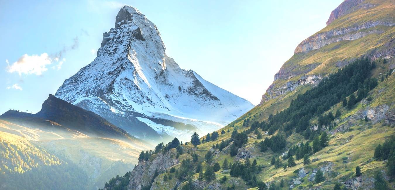
When you ride the train into Zermatt, the first thing you notice is the piercing, pyramid-shaped Matterhorn. The near-symmetrical mountain has inspired hikers, mountaineers, and nature lovers for centuries. Near the base of this iconic peak, the Swiss village of Zermatt retains a traditional atmosphere and welcomes tourists from across the globe.
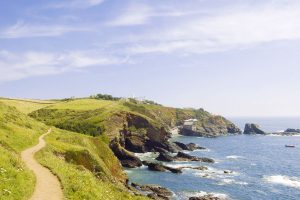
We couldn’t take our eyes off the Matterhorn and were itching to find the best trails in Zermatt to appreciate its beauty. The car-free town is easy to navigate, and top-notch transport makes accessing trailheads a breeze. Although the Matterhorn is visible from Zermatt, you must venture into the alpine wilderness for the best views.
To help you find the most unforgettable Matterhorn views, we’ve prepared this Zermatt hiking guide for you. Some of the trails listed are among the best hikes in Switzerland and present breathtaking alpine vistas. Regardless of the hiking trails you prefer, you can’t go wrong and will leave Zermatt with memories you’ll cherish forever.
Where is Zermatt and how to get there
Zermatt is a fairytale alpine resort located in the Valais canton of Switzerland. Switzerland’s Sion Airport is the closest airport to Zermatt at around 82km from the resort. However, you can also access Zermatt from the larger airports at Milan, Geneva, and Zurich. At the base of the world-famous Matterhorn, Zermatt lies near the Swiss-Italian border.
Although it’s possible to rent a car from one of the nearby airports, we don’t recommend doing so. Zermatt doesn’t allow cars, and the farthest you can drive is the Täsch railway station. From here, you must park your car and ride the cog railway the rest of the way. You can also access Zermatt via the Glacier Express Route or ski resort transfer service from the airport.
Get the SWISS TRAVEL PASS!
Experience seamless and unlimited travel across Switzerland’s trains, buses, and boats, making your journey as memorable as it is easy.
Zermatt trail map
Must Read: 5 Hikes in Mürren For Daredevils
5 best hikes around Zermatt
It’s all about the Matterhorn when tackling the best Zermatt hiking trails. Many paths cut through the landscape around the famous mountain and give you many unique viewpoints.
Whether you face the rocky pyramid at high elevations or view its reflection in alpine lakes, there are dozens of trails to view the beloved mountain. Here are 5 of our favorite hikes around Zermatt to marvel at this breathtaking piece of the Swiss Alps:
1. Edelweiss Trail (Höhbalmen)


The Edelweiss Trail ranks among the best hikes in Switzerland for its magical views of the Matterhorn. But prepare yourself for some serious elevation change on this loop trail starting from Zermatt. The total ascent is nearly 1,200m, and it’s a strenuous climb only recommended for avid trekkers.
But as you ascend the rocky landscape, you’ll spot the famous Edelweiss flowers and grazing sheep around the path. The climb takes you onwards to the Hotel Trift, where the Swiss Alps emerge beyond the hilltops. When you finally see the Matterhorn, it’s a surreal moment that makes you stop in your tracks.
Keep trudging along until you arrive at Höhbalmen for the absolute best view of the Matterhorn. From here, you stare directly at the pyramidal-shaped peak and have a heart-racing panorama of jagged peaks and mighty glaciers. You’ll be gasping for air after the ascent, but this million-dollar shot is worth it.
- Distance: 20.7 km (12.8 miles)
- Duration: 7-8 hours
- Difficulty: Hard
- Starting Point: Zermatt Station
- Route Type: Loop
Map not loading? Click here or on the title of the trail on the right corner of the map, to get more information.
2. 5 Lakes Walk


- Distance: 9.8 km (6.1 miles)
- Duration: 3-4 hours
- Difficulty: Medium
- Starting Point: Blauherd Station
- Route Type: Loop
The 5 Lakes Walk isn’t as strenuous but offers stunning views of the Matterhorn reflecting in alpine lakes. Although the trek starts at around 2,500m above sea level, a cable car escorts you to the trailhead. The minimal ascent makes this hike the best Zermatt hiking trail for all skill levels to view the Matterhorn.
Along the way, the path wanders around the gorgeous Stellisee, Grindjisee, Grünsee, Moosjisee, and Leisee lakes that adorn the landscape. Each lake boasts unique scenery, activities, and Matterhorn views as you explore the plateau.
Stellisee has the most spectacular vantage of the Matterhorn as the pyramid rises above you and reflects on the lake’s surface. Idyllic forests and blooming wildflowers surround Grindjisee as the Matterhorn forms the backdrop. Grünsee features rocky landscapes and glacial vistas, while Moosjisee has a milky-blue color. And for a refreshing swim, the shores Leisee are perfect for a dip while gazing at the Matterhorn.
Map not loading? Click here or on the title of the trail on the right corner of the map, to get more information.
Check out: 5 hikes To Conquer in Appenzell
3. Hörnli Trail


- Distance: 14.5 km
- Duration: 4-5 hours
- Difficulty: Hard
- Starting Point: Steg im Tösstal
- Route Type: Point to Point
The Matterhorn is among the world’s most dangerous mountain climbs, and Hörnli Hut is the epicenter of Zermatt’s mountaineering culture. The climbers who first summited the iconic peak started their journey here, and modern-day mountaineers still use Hörnli Hut as their basecamp. But the hike along the Hörnligrat ridge is an adventurous Zermatt hiking trail that makes a steep ascent to the foot of the Matterhorn.
While this isn’t the lengthiest trek, there are some rock scrambles and sections around sharp drop-offs. But metal walkways, ropes, and chains help you on the most challenging parts of the climb. When you get closer to the hut, the vistas of the surrounding snowy peaks are pure magic. The trek also passes the serene Schwarzsee lake that has a chapel hugging the shoreline.
If you have time for one night at the Hörnli Hut, you can feel the mountaineering atmosphere around you. During peak climbing season, expert climbers prepare their gear and mentally ready themselves for a daring expedition. Plus, you can watch mountaineers climbing the Hörnligrat with close-up views of the Matterhorn. If you must return to Zermatt, make the 4.3km descent back towards the Schwarzsee cable car station.
Map not loading? Click here or on the title of the trail on the right corner of the map, to get more information.
4. Swiss Topwalk


- Distance: 6.4 km (3.95 miles)
- Duration: 4-5 hours
- Difficulty: Hard
- Starting Point: Riffelalp
- Route Type: Point to Point
This scenic route offers epic views of the Matterhorn as you hike towards the famous Gornergrat. The journey features different angles of the Matterhorn, fellow 4,000m peaks, and the mighty Gorner Glacier. Before your steep ascent to the Gornergrat, you’ll meet the sparkling shores of Riffelsee lake. The alpine lake has one of the best Matterhorn views, and the mountain’s reflection is a must-see sight.
After a vicious 900m climb to get your blood flowing, enjoy the scenic views from the Gornergrat platform. The 360° views of the Swiss Alps leave you speechless while you breathe the crisp mountain air from over 3,000m elevation. If you need an energy boost, another unique thing to do in Zermatt is to have a snack or cup of coffee at Hotel Gornergrat Kulm. At 3,120m, it’s the highest hotel in the Swiss Alps.
Map not loading? Click here or on the title of the trail on the right corner of the map, to get more information.
Must Read: 5 hikes Around Interlaken For Adventure Seekers
5. Glacier trek to the Monte Rosa Hut


- Distance: 7.1 km (4.4 miles)
- Duration: 4-6 hours
- Difficulty: Hard
- Starting Point: Rotenboden
- Route Type: Point to Point
If you pack or rent crampons, you have the unique opportunity to experience Zermatt glacier hiking. The trek to Monte Rosa Hut presents the challenge of hiking atop glaciers and moraines. Shortly after Rotenboden, you’ll need those crampons to climb the Gorner Glacier. The 12.9km ice cap is among the longest glaciers in the Swiss Alps and offers dramatic views of 4,000m peaks.
As you ascend the icy glacier, blue-white marks on the rocky surface point you towards the Monte Rosa Hut. The steady climb to the hut makes the glacial trek a difficult endeavor as you battle the elements. But your vantage of the Gorner Glacier only gets more awe-inspiring the farther you go.
Due to the glacier’s melting, the hike has become riskier for trekkers wishing to walk atop the ice cap. It’s highly recommended to book a mountain guide when including this route on your mountain hiking holiday. When you arrive at the Monte Rosa Hut, you enter an alpine paradise engulfed by jagged peaks, glaciers, and blankets of snow.
Map not loading? Click here or on the title of the trail on the right corner of the map, to get more information.
Must Read: The Ultimate Switzerland Hiking Guide
What else to do in Zermatt?


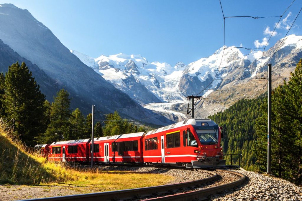
After you’ve conquered several Zermatt hiking trails, give your legs a well-deserved rest with two thrilling rides. Zermatt allows everyone to appreciate the alpine vistas formed by the Matterhorn and other impressive peaks adorning the landscape.
The technological achievements to travel across glaciers and reach heights over 3,000m is remarkable to witness. And whatever you do, don’t forget your camera before the ride begins. Trust us; you’ll regret not having shots of these unforgettable mountain views.
Ride the Gornergrat Bahn Cogwheel Train
The Gornergrat cogwheel train offers you the best Matterhorn views that money can buy. This heart-racing ride coasts up the side of a glacier and presents unbelievable vistas of the Swiss Alps. With the Matterhorn as the crown jewel, you’ll see 29 4,000m peaks once at the viewing platform.
The journey takes you through pristine forests, around alpine lakes, and through dark tunnels. Once you’re at the 3,089m observation deck, you have a perfect vantage of the Matterhorn and Gorner glacier. If your legs require a break, this is the best Zermatt activity for exhilarating mountain vistas.
Ride the Matterhorn Glacier Paradise Cable Car
How does a ride on the world’s highest cable car sound? The Matterhorn Glacier Paradise ascends to heights no other cable car can reach. Hitch a ride at the Zermatt-Matterhorn Valley Station and watch the landscape transform before your eyes. Begin by soaring above green meadows and verdant forests, then enter a world of jagged peaks and immense glaciers.
Europe’s highest mountain station is the final destination, and you’ll stand at an elevation of 3,883m. The viewing platform provides miraculous views of the Swiss, French, and Italian Alps and over a dozen icy glaciers. Before you leave, visit the cinema lounge to learn more about this alpine paradise.
We love to hear from you
Thanks for checking out our Zermatt hiking guide. Hopefully, this has provided the information you need to plan an adventurous trekking vacation in Switzerland. If you have have any questions or want to share your hiking experiences from Zermatt or if you have other tips or trails to recommend, please leave a comment below.
For more information about Switzerland, please visit this Switzerland Travel Page. Or check our travel tips for more general travel information!